Skip to content

Real Cape Cod places, checked by us — not ranked by algorithms.

Explore what's here
1 / 8
Hard5 miOrleans

Nauset Beach to Pochet Island Walk

CCC VisitedVerified Oct 5, 2026

Save 3 places you love with a free account. Create your free account

What is Nauset Beach to Pochet Island Walk like?

A roughly 5-mile round-trip beach and barrier-spit walk from the south end of the Nauset Beach lot out toward Pochet Island, crossing soft sand, dunes, and salt marsh. Strenuous footing throughout; reaching Pochet itself requires crossing the marsh on foot and is tide-dependent, so the island can be cut off at high tide. Excellent birding. Pochet is privately owned with a conservation restriction held by the National Park Service — stay on public areas and respect private property. Dogs subject to seasonal Nauset Beach restrictions (off-season only).

Plan your walk

Nauset Beach to Pochet Island Walk

Directions to the trailhead (opens in a new tab)

Nauset Beach, 250 Beach Road, Orleans, MA 02653

Check conditions before you go. Trail details from Mass Audubon / Town of Orleans (opens in a new tab)

When should you go?

Best time to go

Checking today’s weather and sun times…

Now41°FOvercast
Wind5 mphFrom the S

Weather and sun times from Open-Meteo for the nearest part of the Cape.

What’s the trail like?

Length
5 mi
Difficulty
Hard
Surface
Sand
Dogs
Off-season only
Kids
Not noted
Accessible
Not noted
Views
Ocean
Good for
Hiking, Beach walk, Birding

What should you know before you go?

Parking

Nauset Beach town parking lot (fee in season); start from the south end of the lot

Dogs

Off-season only

Managed by

Town of Orleans (Nauset Beach) / Cape Cod National Seashore

What you'll see

Ocean views, Salt marsh, Dunes, Bird sanctuary

Where is the trailhead?

Nauset Beach, 250 Beach Road, Orleans, MA 02653.
Get directions

Where else can you walk in Orleans?

  • Jonathan Young Windmill, OrleansEasy

    Jonathan Young Windmill

    Town of Orleans (Parks and Beaches Department); restored by the Orleans Historical Society

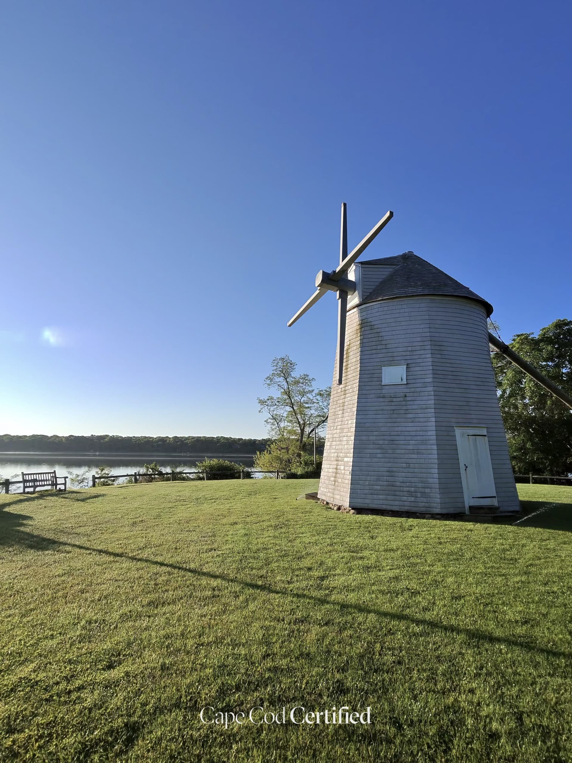
    The Jonathan Young Windmill stands in a small park on the shore of Town Cove in Orleans, a shingled mill on a sloping lawn above the water. The Orleans Historical Society says it was built in South Orleans in the early 1700s, moved to overlook Town Cove by 1839, and still has all of its early parts and machinery intact. In 1990 the Society donated it to the town as part of Town Cove Park. The mill is open to the public in July and August, and early morning light across the cove makes it a lovely stop.

    CCC Visited · Verified 2026-10-06

  • Kent's Point Conservation Area, OrleansEasy · 1.5 mi

    Kent's Point Conservation Area

    Mixed · Town of Orleans / Orleans Conservation Trust

    A 27.7-acre town conservation area at the end of Frost Fish Lane with about 1.5 miles of well-maintained trails (including the Cove Trail and River Trail) winding through woodlands and over a mile of undeveloped shoreline. The main path leads to a handicapped-accessible boardwalk overlooking The River and the northern reach of Pleasant Bay, with views of Lonnie's Pond and Frost Fish Cove. Great blue herons are common in winter. Dogs welcome on leash.

    CCC Visited · Verified 2026-06-25

  • Easy · 1.5 mi

    Ice House & Reuben's Ponds Conservation Trail

    Natural trail · Orleans Conservation Trust

    A 1.5-mile loop system through pitch pine and oak woodland connecting Ice House Pond and Reuben's Pond. Bench overlooks each pond; plant ID tags throughout. A children's Storybook Trail loop (0.75 miles) takes families through picture-book stations at nature stations. Ice House Pond is among the healthiest in Orleans and popular with birders year-round for migrating waterfowl.

    Listed & Verified · Verified 2026-06-25

  • Easy · 1 mi

    Mill Pond Valley Conservation Trail

    Natural trail · Orleans Conservation Trust

    A quiet 1-mile trail through 13 acres of conservation land leading from Champlain Road to the shoreline of Mill Pond in East Orleans. Features historic stone walls, a vernal pool, and a coastal plain pond that draws migrating wood ducks and waterfowl. Lightly traveled and ideal for birdwatchers. Trail ends at a viewpoint above Little Cove on Mill Pond.

    Listed & Verified · Verified 2026-06-25

  • Easy · 0.5 mi

    Peck Conservation Area (Arey's Pond Overlook)

    Natural trail · Town of Orleans Conservation

    A short, peaceful walk through 10 acres of conservation land overlooking the entrance to Arey's Pond, a tidal cove connecting to Pleasant Bay. The John Kenrick Woods trail network to the north also terminates at a viewpoint above Arey's Pond. No facilities; stay on marked paths to protect sensitive shoreline. Best in early morning for birding over the pond.

    Listed & Verified · Verified 2026-06-25

  • Easy · 1.5 mi

    Namskaket Creek Beach Walk

    Sand · Town of Orleans / Orleans Conservation Trust

    A 1.5-mile round-trip beach walk from Skaket Beach across soft tidal sand to Namskaket Creek, a 200-acre saltmarsh straddling Orleans and Brewster. One of the most ecologically significant tidal corridors on the inner Cape, rich with shorebirds, herons, and migratory waterfowl. Part of the emerging Cape Cod Sea Path multi-town coastal route.

    Listed & Verified · Verified 2026-06-25