Megansett Beach
- Parking and access: Resident sticker only
- Dogs: Off-season only
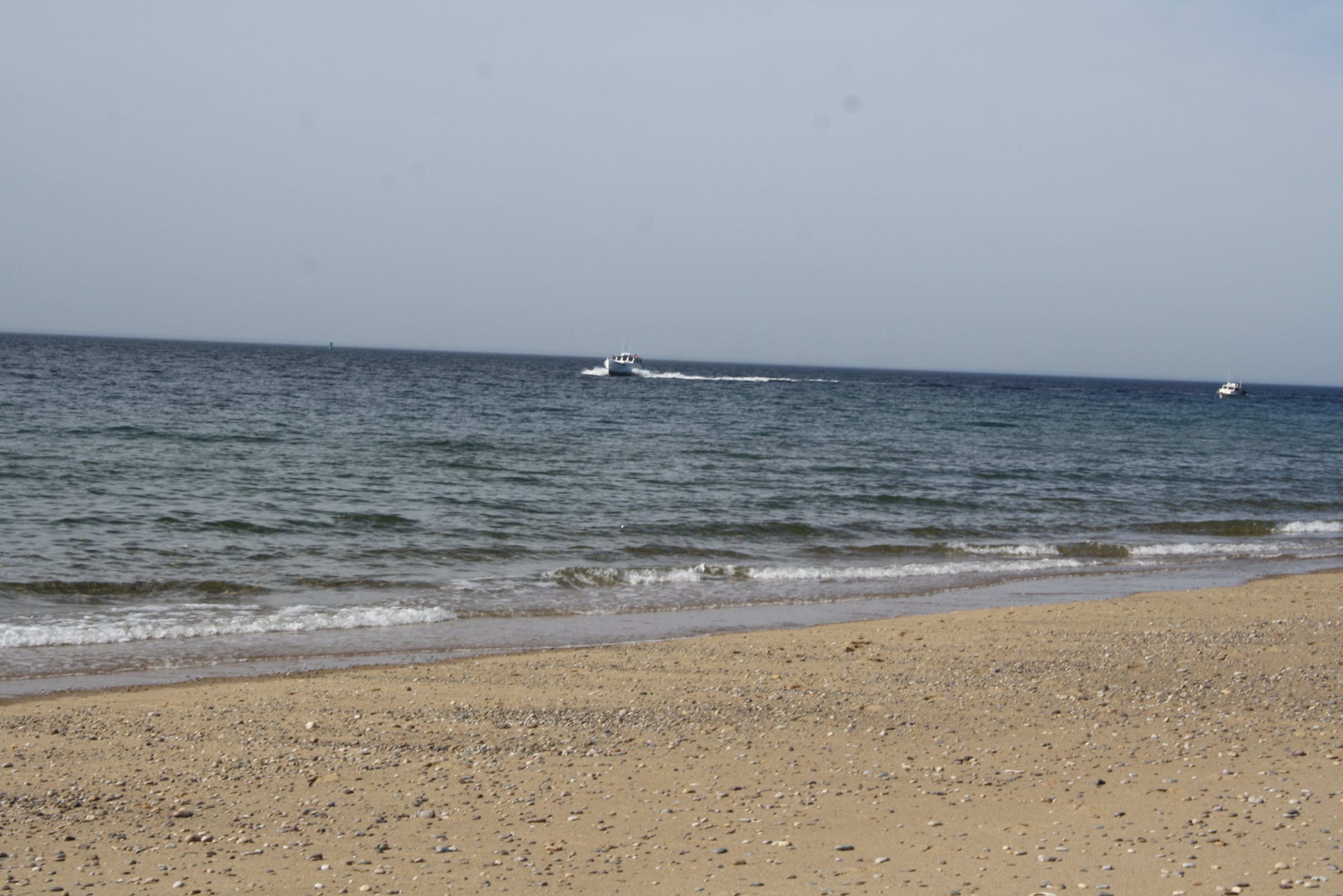
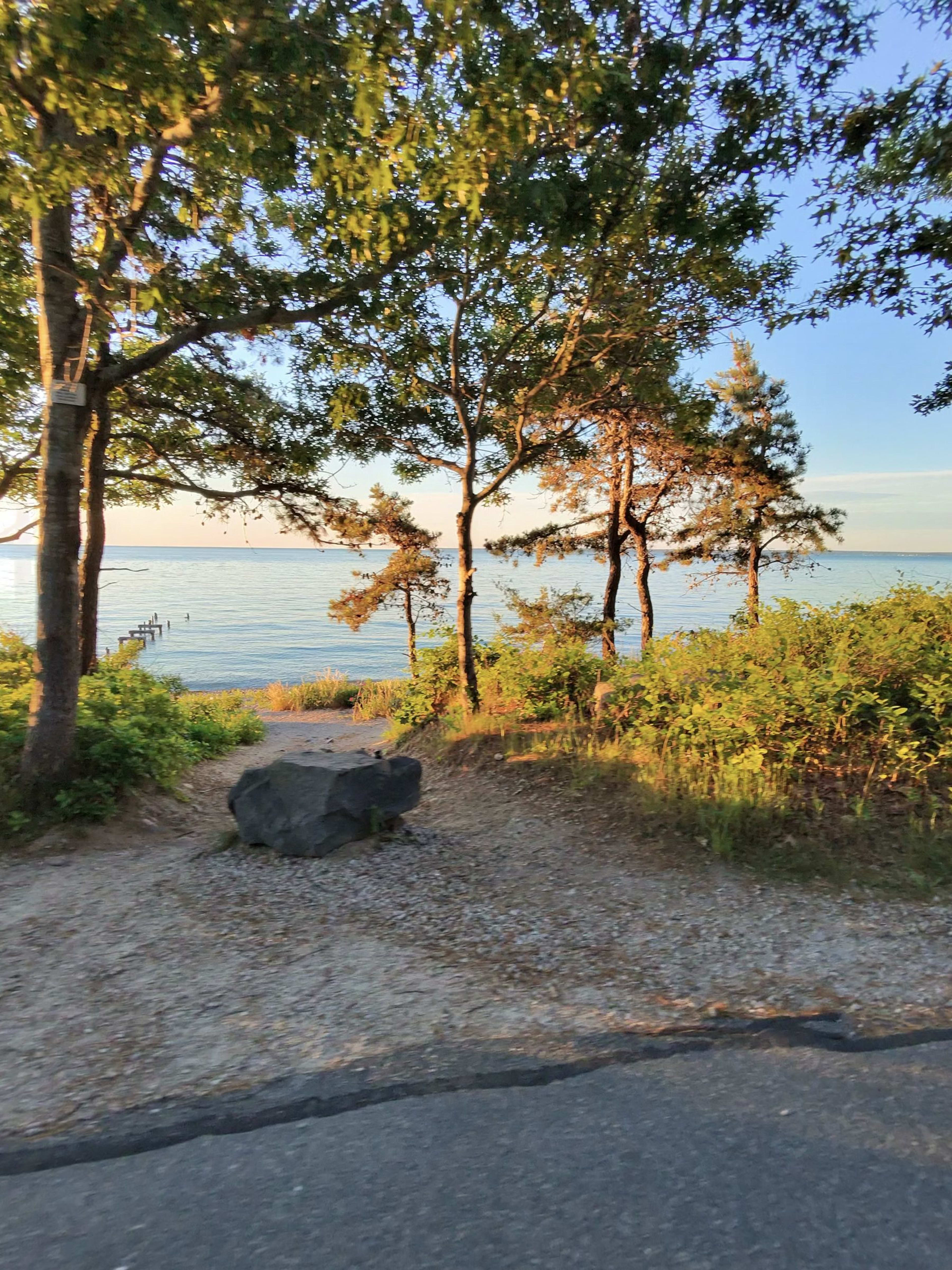
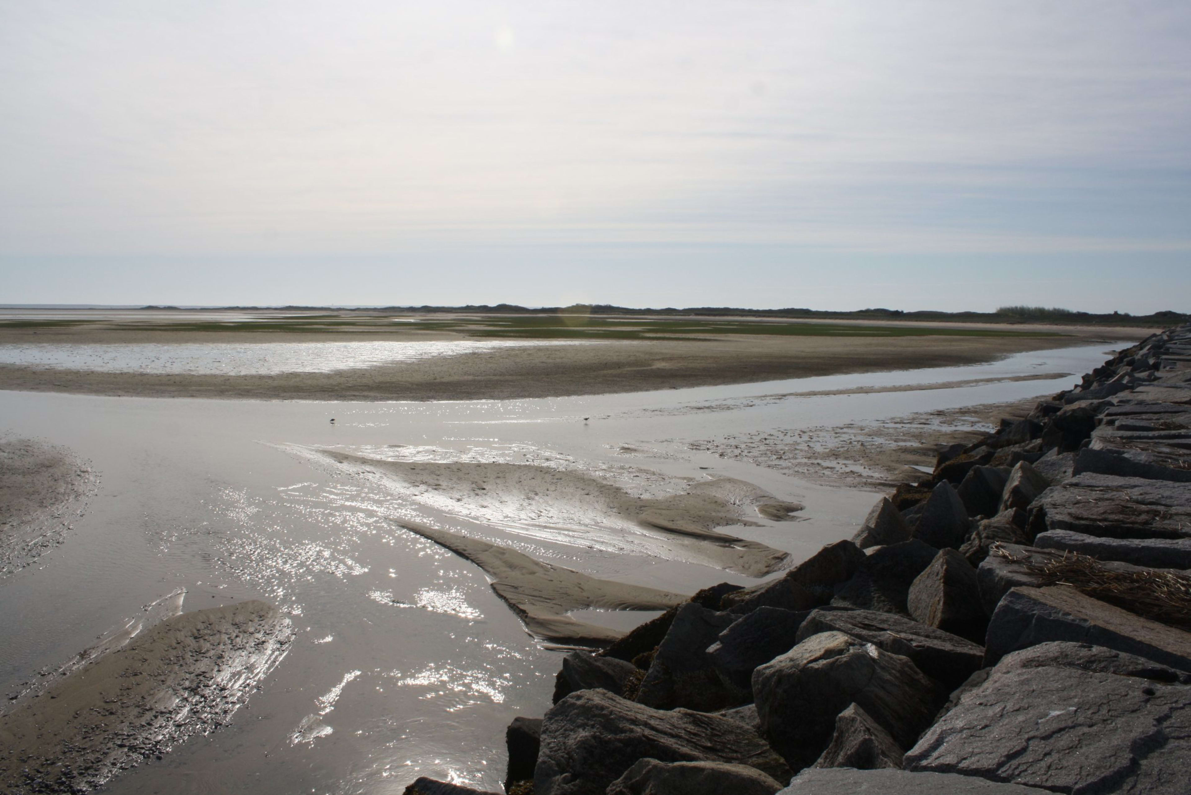
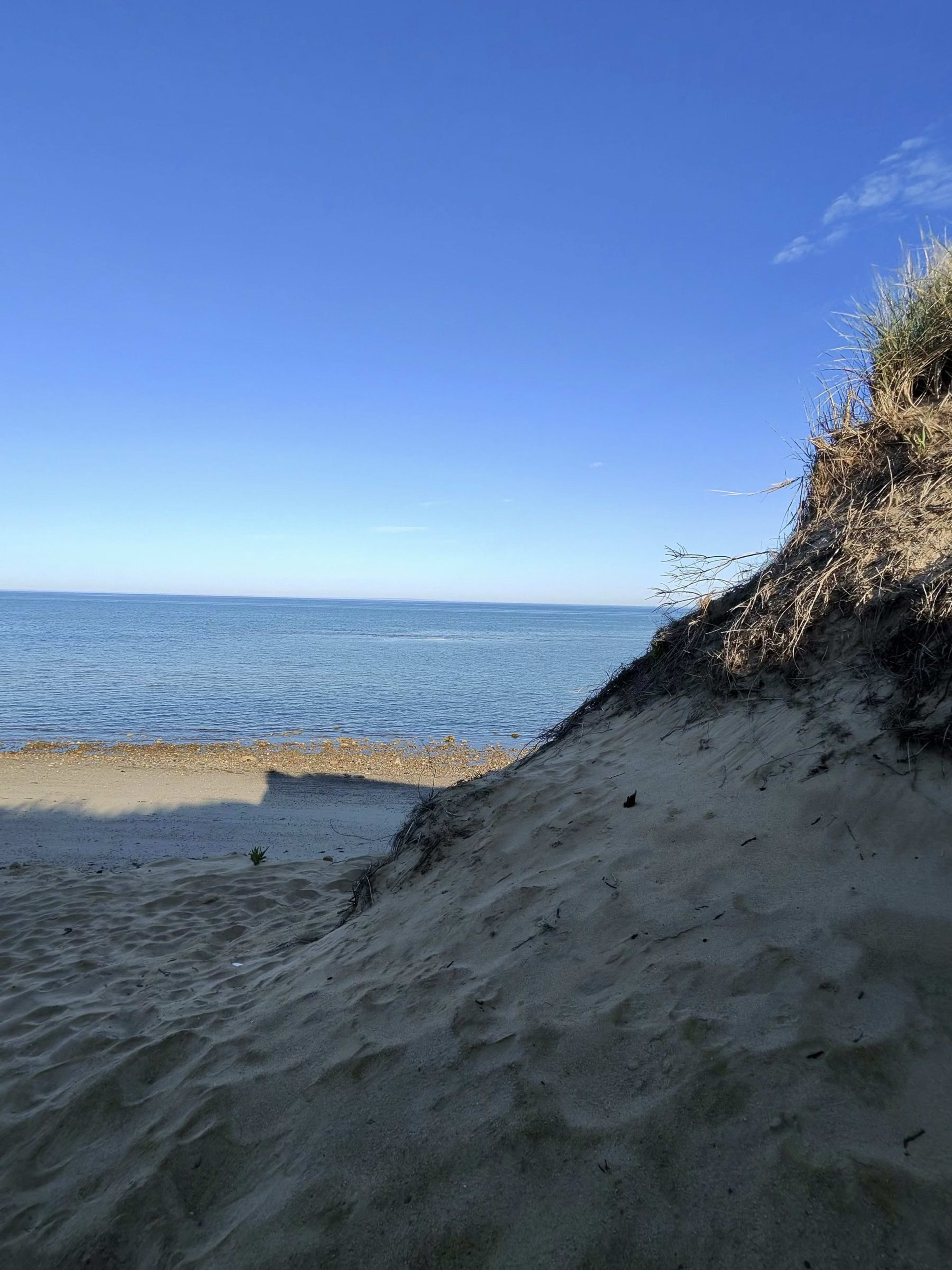
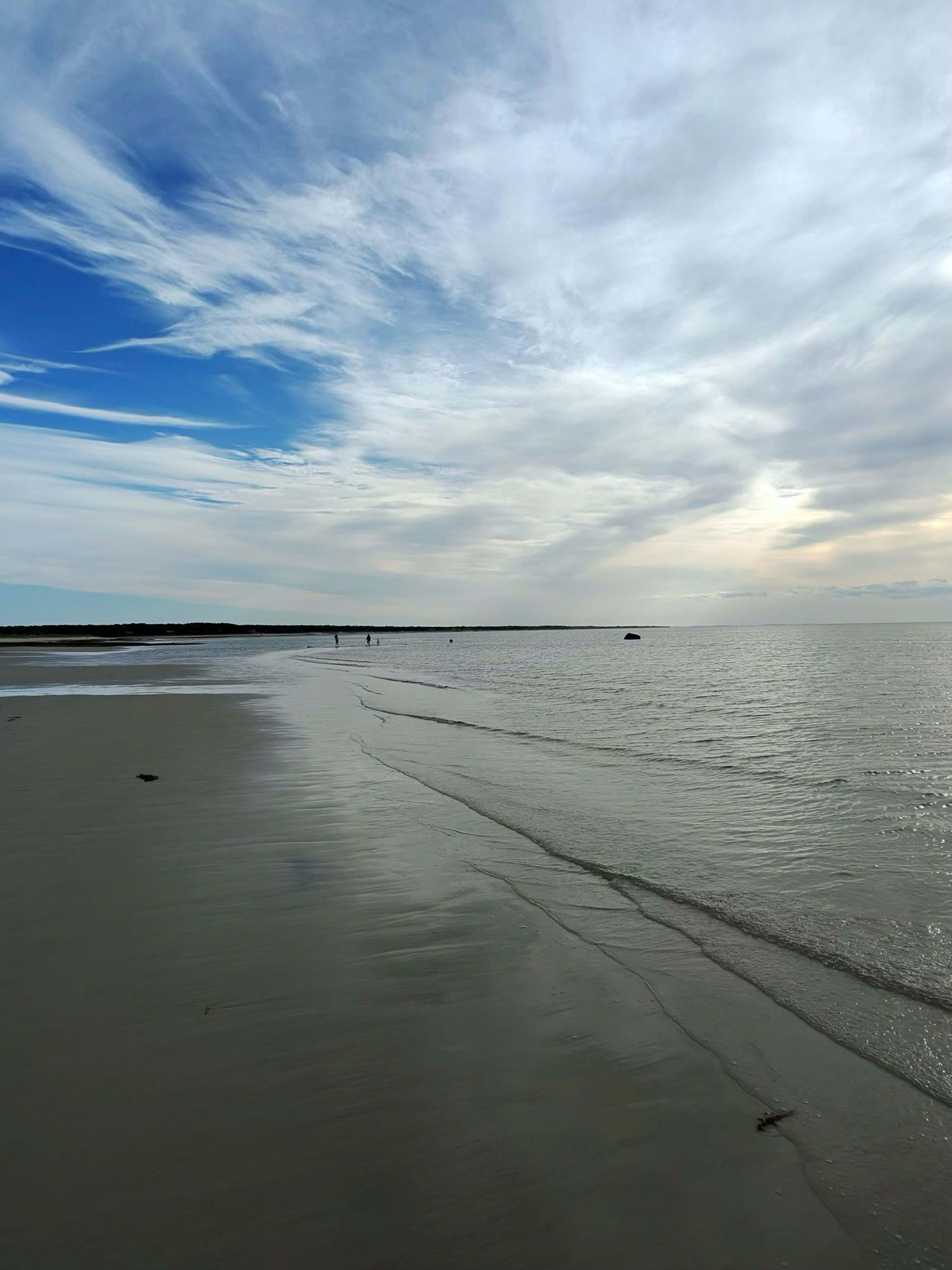
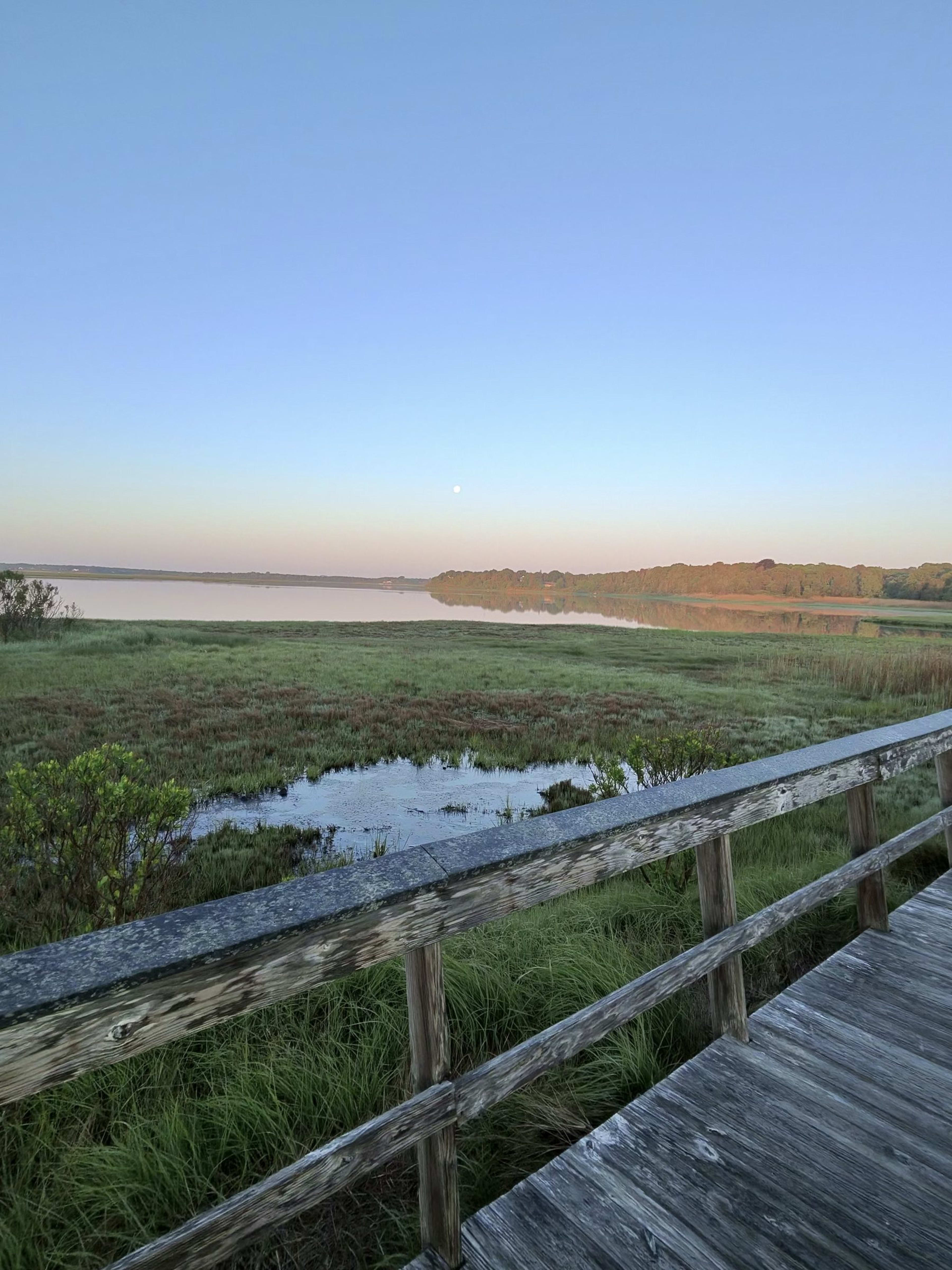
Sheltered North Falmouth beach on Buzzards Bay beside a small harbor — calm, shallow water and a quiet, local, family feel.
With Kids
Beach day. Cape Cod with kids, done right.
Updated September 29, 2026
Beaches best suited for families and young kids, grouped by region.
Sheltered North Falmouth beach on Buzzards Bay beside a small harbor — calm, shallow water and a quiet, local, family feel.
A clear, spring-fed freshwater kettle pond off Route 130, popular with local families for warm, calm swimming with no surf or tide. Designated an accessible access point with a beach mat. Resident sticker required.

Sandwich's marquee Cape Cod Bay beach, anchored by the iconic Sandwich Boardwalk over Mill Creek marsh. Calm bay water, wide tidal flats at low tide, and sweeping sunset views west across the bay. Restrooms (portable units from June 1, full facilities mid-June) and a beach accessibility mat. A short walk along the boardwalk connects the parking area to the sand.
Long, walkable Vineyard Sound beach minutes from Main Street, with a warm tidal 'kiddie pool' lagoon at the east end. The closest beach to downtown Falmouth.
A small neighborhood Buzzards Bay beach in the Buzzards Bay village with restrooms and a boat ramp. Calm, protected water makes it convenient for residents and small-boat launching.
Town-managed freshwater pond beach adjacent to Falmouth Heights. Protected from ocean winds, warm water, and a sandy beach entry. A local favorite for residents avoiding the saltwater crowds.
Free freshwater swimming pond in Goodwill Park, with a lifeguarded beach, picnic groves and walking trails — no sticker or fee required.

The famous Sandwich Boardwalk stretches roughly 1,350 feet across Mill Creek and salt marsh out to the bay-side dunes and beach. A beloved spot for strolling, birdwatching, crabbing off the planks, and watching the sun set over Cape Cod Bay. Connects to Town Neck Beach. Restrooms available seasonally.
Popular town freshwater beach on John's Pond with a designated swimming area, kids' play area with slides and swings, picnic tables, restrooms and in-season lifeguards. A go-to spot for Mashpee families.
Town freshwater beach on the southern end of Mashpee-Wakeby Pond. A family favorite with a playground, basketball hoop, picnic area, seasonal restrooms and summer lifeguards. Calm, shallow water makes it well suited to young children.
A town-owned freshwater pond (also called Flax Pond) in Pocasset with a long sandy shoreline and warm, shallow water that is great for swimming and wading. Rarely crowded - a quiet alternative to the saltwater beaches.
State park on Nantucket Sound administered by the Massachusetts Department of Conservation and Recreation, part of the Waquoit Bay National Estuarine Research Reserve. Wide sandy beach with dunes, salt marsh and walking trails; a large public lot makes it accessible to non-residents for a daily fee.
Town of Mashpee freshwater pond beach at Santuit Pond. Calm, clear water in a wooded setting. Open to Mashpee residents and their guests. Good for swimming and non-motorized boating.
A six-mile barrier beach along Cape Cod Bay reached via the East Sandwich gatehouse off Route 6A, though the beach itself is managed by the Town of Barnstable. Full amenities at the main beach: lifeguards, restrooms, outdoor showers, snack bar, ramp access and a beach wheelchair. Famous for dunes, beachcombing, sea glass, ORV trails, and primitive camping. Note: Sandwich beach stickers are not accepted here.
A large, clear freshwater pond on the Sandwich-Barnstable border. The Sandwich access point offers a sandy beach with calm swimming. Popular with families and anglers.
A small Cape Cod Bay access point at the corner of Town Neck Road and Freeman Avenue, designated as an accessible entry with a beach mat. A popular shore-fishing spot for striped bass and bluefish, and one of the locations where non-resident day and weekly passes can be purchased.
Bourne's flagship town beach on Phinneys Harbor, with a wide sandy shoreline and calm, protected water ideal for families and swimming. Seasonal lifeguards, restrooms and a snack stand, plus a boat ramp and kayak launch. A Mobi-Chair floating beach wheelchair is available in summer.

Falmouth's most popular beach — warm, calm Buzzards Bay water, a tidal sandbar kids love, lifeguards and a snack bar. The sunsets here are the classic Falmouth view.
A 380-acre DCR state reservation at the eastern end of the Cape Cod Canal on Cape Cod Bay. Open to the public for a daily fee, with a bathhouse, restrooms, rinse showers, seasonal lifeguards, a fishing pier, a 100-site campground, and trails along the canal. Leashed dogs permitted April 1-Sept 30 in designated areas.
A Buzzards Bay beach and boat ramp in Pocasset with calm, protected water. A neighborhood favorite for swimming and launching small boats and kayaks.
Town-managed freshwater pond beach in East Sandwich. Shallow, warm water ideal for young children. A neighborhood gem for Sandwich residents seeking calm swimming in summer.
A long stretch of Cape Cod Bay shoreline on the north side of the Cape Cod Canal, split into First Beach and Second Beach. Open water and sweeping sand make it a favorite for residents who want a quieter beach day; parking is limited to Bourne sticker holders.
A quiet freshwater pond in East Falmouth, managed by the Town of Falmouth. Sandy beach with calm, warm water—excellent for families with young children. Less crowded than the saltwater beaches.
A freshwater swimming beach on Wakeby Lake within the Ryder Conservation Area in South Sandwich, surrounded by woodland trails. Quiet, calm water for swimming and paddling, with hiking and nature paths nearby. Resident sticker required.
Marsh-backed Buzzards Bay beach where the Little Sippewissett salt marsh meets the sound — tidal creeks and warm shallows make it a hit with little kids.
Two-section Vineyard Sound beach in East Falmouth with calm water, restrooms and lifeguards — quieter than the Old Silver and Surf Drive crowds.
A large freshwater kettle pond with a town swimming beach at Oak Crest Cove on Quaker Meetinghouse Road. Calm, warm water ideal for families, and staffed during the summer season. Day and weekly passes available in addition to resident stickers.
A sheltered cove beach in Pocasset on Hen Cove, with very calm, shallow water that is good for young families. Has restrooms and a boat ramp for kayaks and small craft.
A quiet Buzzards Bay neighborhood beach in the historic Gray Gables section near the mouth of the Cape Cod Canal. Calm water and restrooms; popular with nearby residents.
Mashpee's town saltwater beach on Nantucket Sound, a narrow mile-long strip of sand adjoining the state-run South Cape Beach State Park. The town lot requires a Mashpee resident sticker; lifeguards and restrooms are provided in season.
Family-friendly Nantucket Sound beach with a playground, gazebo, seasonal bathrooms, a food concession, and an outdoor shower. Hosts a popular summer evening music series at its gazebo.
Yarmouth's largest beach, fronting Nantucket Sound. Wide sandy beach with summer lifeguards, a seasonal bathhouse with showers, a food concession, and a large parking lot. The town's flagship swimming beach.
A scenic peninsula beach in Osterville bordered by Nantucket Sound on one side and East Bay on the other, offering both open-water and protected calm-water swimming. Lifeguards on duty daily 9am-5pm in summer. Resident/taxpayer parking only. Dogs allowed off-season only.
Town beach access on Lake Wequaquet, the largest freshwater lake on Cape Cod. Warm, calm water in summer makes it extremely popular for family swimming. The large lake surface also draws sailors and kayakers. Sandy bottom and gradual entry are ideal for children.
Dennis's most famous Cape Cod Bay beach, renowned for its vast tidal flats that extend nearly a half-mile at low tide, creating warm shallow pools ideal for young families. Calm bay water, classic Cape Cod sunsets over the water, and excellent shelling.
A peaceful freshwater swimming spot on Follins Pond in South Dennis, set along a quiet road with soft sand and clear water. Popular with kayakers, anglers, and families looking to avoid the crowd. Limited street parking; a small boat launch is also on site.

One of Cape Cod's most popular south-facing beaches on Nantucket Sound. Wide sandy shore with warm calm water, ideal for families. Located at the end of Craigville Beach Road in Centerville.
A mile-plus-long Nantucket Sound barrier beach off Davis Beach Road, just east of the mouth of Bass River, with one of the largest beach parking lots on Cape Cod. Warmer Sound water, steady breezes that draw windsurfers and kite-flyers, lifeguards, and a back-side salt marsh.
Sound-front beach at the mouth of the Bass River, also known as Smugglers Beach. Features summer lifeguards, seasonal bathrooms, a food concession, a boat ramp, and a fishing deck. A popular spot for sunset and watching boats enter the river.
A freshwater swimming beach on Scargo Lake, a glacial kettle pond, offering a calm, fresh-water alternative to the ocean beaches. Shaded picnic area and gentle entry make it ideal for families with small children; lifeguarded in season.
A small, quiet Cape Cod Bay beach in East Dennis named for the old fishing cold-storage building that once stood nearby. Calm bay water and views toward Sesuit Harbor make it a relaxed local favorite for families and sunset watchers.
Small, scenic beach on the western shore of West Bay in the heart of Osterville village. The calm, warm bay water and gentle bottom make this a quintessential quiet Cape Cod village beach. Popular with local families; lovely sunsets west across the bay.
Bayside beach on Cape Cod Bay famed for its long boardwalk over a tidal salt marsh and dramatic sunsets. Features a picnic area, pavilion, and seasonal bathrooms. Calm, shallow water at high tide; expansive flats at low tide.
Sandy harbor-front beach at Blish Point adjacent to Barnstable Harbor marina and boat launch. A quiet spot to watch fishing vessels and pleasure boats come and go. Calm harbor water; good for small kids and watching watercraft. Views across the harbor to Sandy Neck.
Small neighborhood beach on Nantucket Sound in the quiet Hyannisport enclave. Calm protected water makes it popular with families and young children. Views toward the Kennedy compound area and across Lewis Bay.
A quiet Cape Cod Bay beach tucked just east of Corporation Beach, sharing the same calm tidal flats and sweeping bay views. Less crowded than its neighbor, it offers a boardwalk access, soft sand, and classic north-side Dennis character. Lifeguards are on duty in season; restrooms are a short walk at Corporation Beach.
Also known as Sea Street Beach, this Nantucket Sound beach at the end of Sea Street in Hyannis offers warm, calm water and a snack bar, making it a favorite for families. Walkable from downtown Hyannis. Dogs allowed off-season only.
A small peaceful Cotuit town beach on Cotuit Bay with calm shallow water. Quieter than nearby Loop Beach and beloved by locals.
A mid-sized Nantucket Sound beach on South Shore Drive in South Yarmouth, sitting at the east side of Parkers River mouth. Clean sand, a concrete seawall walkway, and a picnic area make it a comfortable family destination. Tends not to get overly crowded; parking is right beside the beach.
A popular freshwater kettle pond off Phinney's Lane in Hyannis, ringed by woods with a nature trail loop. Clear, calm water and lifeguards make it a family favorite away from the ocean crowds. Dogs allowed off-season only.
A wide, sandy Nantucket Sound beach at the mouth of Hyannis Harbor, famous as one of Cape Cod's premier windsurfing and kiteboarding spots thanks to its steady breezes. The protected harbor side offers calmer, warmer water for swimming. Dogs allowed off-season only (Sept 16-May 14).
Freshwater pond beach on Joshua's Pond in Marstons Mills. A classic mid-Cape kettle pond with clear cool water. Small sandy swim area popular with families and local children during summer. Relatively undiscovered compared to larger pond beaches elsewhere in Barnstable.
The main Cotuit town beach on Nantucket Sound, with calm warm water and a classic New England village beach feel. Named for the loop road at the parking area.
A neighborhood Nantucket Sound beach in Dennis Port with warm, calm south-facing water that's well suited to families and young swimmers. Lifeguarded in season.
Freshwater kettle pond beach on Santuit Pond in Cotuit. Quiet and local-feeling with calm, cool water. A good spot to escape the summer crowds while still getting a swim. Adjacent conservation land adds to the natural setting.
A clear, spring-fed freshwater pond in Marstons Mills popular for swimming and fishing, with calm, warm water that's ideal for young children. Resident/taxpayer parking only. Dogs allowed off-season only.
Small Lewis Bay beach in West Yarmouth reached by a wooden bridge over a marsh, with an adjacent marina. Calm, shallow water makes it good for young families; small parking lot and seasonal portable restroom.
A calm, family-friendly Nantucket Sound beach next to the JFK Memorial in Hyannis, with a gentle slope and shallow water ideal for young children. An adjacent picnic area and proximity to downtown Hyannis make it a popular choice. Dogs allowed off-season only.
A quieter Nantucket Sound beach just west of Craigville Beach in Centerville, popular with locals and less crowded than its neighbor.
A crescent-shaped Cape Cod Bay beach (also historically called Nobscussett Beach) with a stone jetty, grassy bluff with picnic area, and gentle bay surf. Popular for swimming and sunsets, with full facilities including a snack bar and lifeguards.
A Cape Cod Bay beach near the Dennis/Yarmouth line with gentle surf, tidal flats at low tide, and beautiful sunset views over the bay. Lifeguarded in season and popular with families.
Town-access beach on the western shore of Lewis Bay. Sheltered from ocean swells, offering calm swimming and kayak launch access. Convenient to Hyannis center and ferry area. Popular with locals who bypass the busier Kalmus and Veterans Park beaches.
Brewster's easternmost bay beach, with the town's largest beach parking lot and a wide, sandy shoreline. Backed by conservation land near the Orleans line, it offers the classic Brewster flats experience at low tide with expansive sandbars for walking and shelling. Calm bay water and west-facing sunsets. Portable restrooms June through Labor Day; no lifeguard.
A popular Harwich Port beach with wonderfully soft sand and panoramic views of Nantucket Sound, within walking distance of Harwich Port shops and restaurants. Lifeguarded with restrooms, a bike rack, beach wheelchairs and mobile concessions; parking requires a season sticker (no daily passes sold here).
The largest kettle pond in Nickerson State Park at 206 acres, Cliff Pond offers a sandy swimming beach with clear water and impressive depth. Supervised by lifeguards in summer, with a boat launch on the Nook Road side. Accessible on foot from camping areas 4, 6, and 6x. A beloved Cape Cod freshwater escape with picnic areas and kayak-friendly shores.
Brewster's largest freshwater kettle pond and a popular warm-water swimming spot, shared with neighboring Harwich. The town beach has a lifeguard on duty roughly 9am to 5pm from June through Labor Day, making it a good choice for families with young swimmers. Calm, fresh water with no surf. Portable restrooms June through Labor Day.
A clean, family-friendly south-facing beach on Nantucket Sound with gentle, warm water and plenty of parking. Lifeguarded with restrooms, beach wheelchairs and mobile concessions, and one of four Harwich beaches selling daily passes on-site.

One of Brewster's most popular Cape Cod Bay beaches and the closest to the town center. At low tide the water recedes to expose the famous Brewster tidal flats, leaving warm tide pools and sandbars ideal for walking and shelling. Calm bay water and west-facing sunsets make it a family favorite. Portable restrooms June through Labor Day; no lifeguard.
A Cape Cod Bay beach known for its accessibility, with a boardwalk providing wheelchair access toward the shoreline. At low tide the Brewster flats reveal warm tide pools and sandbars stretching far into the bay. Calm water and west-facing sunsets make it a relaxed family beach. Portable restrooms June through Labor Day; no lifeguard.

Calm, warm Cape Cod Bay beach famous for its broad tidal flats at low tide and spectacular sunsets over the water. Seasonal lifeguards, restrooms, rinse stations, and a seasonal snack shack. The shallow, gentle water and expansive flats make it ideal for families with young children. Dogs are not permitted.

Chatham's only public beach combining free parking with lifeguard supervision, Oyster Pond is a tidal saltwater pond whose enclosed, warm, shallow water makes it the safest swimming spot in town for young children. A paved stroller-friendly path leads from parking to shore. The Town of Chatham runs Red Cross swim lessons here each summer.
A freshwater pond beach with calm, warm water and generous parking, popular with families. Amenities include restrooms, handicapped parking, a non-motorized craft launch and mobile concessions; a season sticker is required for parking (no daily passes sold on-site).
A Cape Cod Bay beach reached from Robbins Hill Road, with Mant's Landing nearby. The elevated dune at Robbins Hill is a beloved sunset-watching spot looking west over the bay. At low tide the Brewster flats extend far out, exposing tide pools and sandbars for walking and shelling. Portable restrooms June through Labor Day; no lifeguard.
A clear freshwater kettle pond on Brewster's south side, accessed from Fisherman's Landing. Popular for warm, calm swimming and paddling, it is a quieter alternative to the bay beaches with no surf. Portable restrooms June through Labor Day; no lifeguard.
The largest beach in Harwich, stretching nearly a third of a mile along Nantucket Sound. South-facing with warm, gentle waters and soft sand, plus the town's biggest parking lot, lifeguards, restrooms, beach wheelchairs and mobile concessions. One of four beaches selling daily passes on-site.
A family-friendly Nantucket Sound beach between Hardings and Cockle Cove, with lifeguards, restrooms, and a seasonal concession stand. A tidal creek behind the beach is popular with kids.
A freshwater pond and town swimming beach offering calm, warm water and a small sandy beach. Seasonal lifeguard, picnic areas, and kayak/canoe access. A great backup when the saltwater beaches are crowded or rough. Dogs prohibited June 15 through Labor Day.
A Cape Cod Bay beach where Paines Creek empties into the bay, creating a tidal creek that is a favorite spot for kids to wade and explore. At low tide the Brewster flats stretch out toward the horizon, exposing tide pools, sandbars and clam beds. Known for spectacular west-facing sunsets over the bay. Portable restrooms June through Labor Day; no lifeguard.

A small, calm beach on Pleasant Bay with free parking and protected water. It is the one Chatham beach where leashed dogs are allowed in summer (before 9 a.m. and after 6 p.m.).
A long, popular Nantucket Sound beach in West Chatham with lifeguards, restrooms, and a seasonal concession stand. Good surf, soft sand, and a scenic walk toward Stage Harbor Light.
A 48-acre kettle pond inside Nickerson State Park with a sandy beach, roped swimming area, and lifeguard supervision in summer. Popular with families for its shallow warm water and canoe and kayak rentals available on-site. Handicap-accessible parking adjacent to the bathhouse.
Harwich's premier freshwater swimming beach on Long Pond, with calm, warm water that is ideal for young children and swimming lessons. Amenities include lifeguards, restrooms, a boat ramp, non-motorized craft launch, beach wheelchairs and mobile concessions; one of four beaches selling daily passes on-site.
A quieter Cape Cod Bay beach named for the rocks scattered along the shore. Like Brewster's other bay beaches it sits on the famous tidal flats, where at low tide the water recedes to reveal sandbars, tide pools and clam beds ideal for walking and shelling. West-facing sunsets over the bay. Portable restrooms June through Labor Day; no lifeguard.
A clean, family-friendly south-facing beach on Nantucket Sound with soft sand, warm ocean water and ample parking. Lifeguarded with restrooms, beach wheelchairs and mobile concessions, and one of four Harwich beaches that sell daily passes on-site.
One of Chatham's best beaches for young families, with lifeguards, restrooms, calm shallow water off Nantucket Sound, and a marshy tidal creek that's ideal for wading.

An iconic Atlantic Ocean beach within Cape Cod National Seashore, set beneath the red-and-white Nauset Light — the lighthouse made famous on the Cape Cod potato chip bag. Steep stairs descend the dune to a wide surf beach. Lifeguards are on duty late June through Labor Day. A National Seashore pass (not a town sticker) is required.
A tucked-away Cape Cod Bay beach in South Truro off Ryder Beach Road, with gentle surf, expansive low-tide flats, and classic west-facing bay sunsets. A favorite quiet spot for families and shellers.
Wiley Park is Eastham's freshwater swimming beach on the shore of Great Pond, the town's largest kettle pond. Warm, fresh, still water and a gentle bottom make it ideal for young children and a calmer alternative to the ocean. It is one of the four town beaches that accepts a $30 daily gate pass in addition to the season sticker.
A calm bayside beach in North Truro off Great Hollow Road, with warm shallow water and wide tidal flats at low tide. West-facing over Cape Cod Bay, it delivers some of Truro's signature sunsets in a quieter, residential setting.

Head of the Meadow Beach sits at the edge of the Highland plateau in northern Truro within the Cape Cod National Seashore, offering a broad, uncrowded Atlantic beach backed by characteristic Outer Cape dunes and coastal scrubland. Dual parking lots — one NPS, one Truro town — make it more accessible than most Truro ocean beaches, while the east-facing strand stays refreshingly uncommercial. Reliable surf, excellent long-walk territory in both directions, and sunrise light that arrives early and stays golden.

Cooks Brook is one of Eastham's quieter Bay-side town beaches, tucked at the end of a residential road with a calm, shallow tidal shoreline that rewards patient explorers at low tide. The west-facing exposure serves up reliable sunset views away from the National Seashore crowds, and the smaller scale makes it feel like a neighborhood secret even in high season. Eastham sticker or day fee required.

Sunken Meadow Beach sits along Eastham's Bay-side town beaches, where the tidal flats extend far at low tide making it a favorite for clam diggers, shore birds, and families letting kids loose in ankle-deep water. The wide sandy flats and protected Cape Cod Bay water warm up well by July, creating ideal conditions for young swimmers and anyone who prefers a gentler ocean experience. Eastham sticker or day fee required.

A calm, shallow Cape Cod Bay beach beside Wellfleet Harbor and a short walk from the town center. Warm, gentle water makes it a favorite for young families, and the west-facing bay shore delivers excellent sunsets over the water. No lifeguard.

One of Eastham's three Bay-side town beaches, Campground Beach offers protected, warm-water swimming on Cape Cod Bay with a gently sloping sandy bottom ideal for families with young children. The west-facing shoreline delivers the kind of long, slow sunsets that make the Outer Cape famous, with the water warming noticeably more than the ocean side by midsummer. Eastham resident sticker or day-use fee required; arrive early on summer weekends.
Truro's classic Cape Cod Bay beach off Corn Hill Road, with calm warm water, gentle tidal flats, and famous west-facing sunsets over the bay. One of the few Truro beaches with a daily pay option, making it the easiest for day-trip visitors.
One of Wellfleet's largest glacial kettle ponds, with clear, warm freshwater and a sandy swimming beach. A calm, sheltered alternative to the ocean beaches, popular with families for swimming and paddling. No lifeguard.
A warm, shallow Wellfleet Harbor beach on the bay side, with broad flats exposed at low tide that are ideal for kids and shelling. West-facing for sunset views. Seasonal restrooms; no lifeguard.
A small, quiet Cape Cod Bay beach in South Truro off Fisher Road, with calm water, broad low-tide flats, and west-facing bay sunsets. One of Truro's most low-key residential beaches.

A federally managed Cape Cod National Seashore beach on the bay side of Provincetown, Herring Cove faces west and is one of the Outer Cape's premier sunset-watching spots. Its calmer, gentler water makes it a popular alternative to the surf of the Atlantic-side beaches, and it offers seasonal lifeguards, restrooms, a snack bar with summer evening concerts, and beach wheelchairs available from the lifeguards.
The largest of Wellfleet's kettle ponds, connected to Higgins and Williams ponds by paddle-able channels. Clear, warm freshwater with a sandy swimming beach; Jack's Boat Rental on site offers kayak, canoe, and small-boat rentals. Calm and family-friendly; no lifeguard.

A wide, dune-backed Atlantic-facing beach at the northern tip of Cape Cod within the Cape Cod National Seashore. Known for big open-ocean surf, frequent seal and whale sightings offshore, and the historic Old Harbor Life-Saving Station museum. Seasonal restrooms, showers, and changing rooms are available. Protected shorebirds nest here from late spring through fall, with posted seasonal closures.
A popular Wellfleet kettle pond with a sandy bottom, clear water, and a shaded beach set back from the shore. Favored for swimming, kayaking, and fishing in calm freshwater. No lifeguard.
Small harbor beach adjacent to Wellfleet's working fishing pier and marina. A quiet spot to watch oyster boats and fishing vessels come and go. The protected harbor water is calm and great for young children to splash around. The surrounding area has a charming working-waterfront atmosphere.

The long stretch of sandy harbor shoreline running along Provincetown's waterfront on either side of MacMillan Wharf. Sheltered, calm bay water and an easy walk to shops, restaurants, and galleries make it ideal for swimming, paddling, beachcombing, and long strolls. Tides expose broad flats at low water.

One of Cape Cod's most celebrated Atlantic-facing beaches, part of Cape Cod National Seashore. Backed by a barrier beach and salt marsh, it offers classic open-ocean surf and sweeping sand. In summer there is no direct parking — visitors ride a free shuttle from the Little Creek lot or bike/hike the Nauset Trail from the Salt Pond Visitor Center. Lifeguards staff a designated stretch from late June through Labor Day.

A small, sandy town beach in the heart of downtown Provincetown at the end of Ryder Street, right beside MacMillan Pier. Its calm, clear harbor water makes it a convenient spot for sunbathing, wading, and launching a kayak, with shops, galleries, and restaurants just steps away.
Tidal flat beach accessible by causeway at low tide, offering vast sandbars and calm warm water on Wellfleet Harbor. The island becomes accessible for several hours around low tide, revealing extensive tidal flats ideal for exploring. Families with young children love the shallow, warm water. Check tide charts before visiting — the causeway floods at high tide.

The quiet western stretch of Provincetown's harbor-facing shoreline, away from the bustle of MacMillan Pier. Calm, protected water and lovely views of the harbor and Pilgrim Monument make this a favorite for locals. Warm, flat water is ideal for young children. Sunset views over the bay are exceptional.
Eastham's most famous Cape Cod Bay beach, named for the first encounter between the Mayflower Pilgrims and the Nauset people in 1620. On the west-facing bay side, it is renowned for spectacular sunsets over the water. At low tide the bay recedes nearly half a mile, exposing vast warm tidal flats and pools ideal for walking, shelling, and tidepooling with children. Calm, shallow water makes it a favorite for families.
A quaint neighborhood freshwater pond with a small sandy beach in Manomet, calm and shallow, making it a quiet local favorite for families. There's a boat launch for small craft.
Town waterfront park adjacent to Plymouth Rock and the downtown harbor. A flat, grassy and sandy strip along Plymouth Harbor with calm water, historical views, and easy access to the town wharf and Mayflower II. More of a scenic gathering spot than a swim beach.
Plymouth's largest park, 200 acres of forest and shoreline wrapping Little Pond and the Billington Sea, with a spring-fed freshwater swimming beach that draws visitors from across Massachusetts. Swim lessons run weekdays and there's a launch for small non-motorized boats.
Plymouth's newest park-and-beach on a freshwater pond in Cedarville, built out as a full recreation complex with a playground, sports field, tennis, basketball, beach volleyball and horseshoes alongside the swimming beach.
Plymouth's signature ocean beach, a long sandy barrier spit curling into Plymouth Harbor that's hugely popular with locals and tourists alike. Staffed daily with lifeguards and a bathhouse from late May through Labor Day, with beach wheelchairs and Mobi-mats for accessible access.
Onset Beach is Wareham's popular village beach on the protected waters of Onset Bay (part of Buzzards Bay), in the heart of historic Onset Village near the Onset Bay Pavilion bandshell. Its sandy, gently sloping shore and calm water make it a family favorite, with seasonal lifeguards (late May through Labor Day), restrooms, showers, a concession stand, and a kayak rental center on site. Open dawn to dusk.
An 11-acre waterfront green on Plymouth Harbor with a small sandy beach, a summer splash pad, playground and picnic area, plus a kayak/canoe launch. A paved harborfront path links to the North Plymouth Rail Trail and Holmes Reservation.

Shell Point Beach sits on a point overlooking the busy Onset Bay to the east and the calmer Shell Point Bay to the west. Its warm, shallow water and sandy shore backed by a grassy park make it especially good for families with small children, while the open western view is a fine sunset spot. A great launch point for kayaks and paddleboards, and you can walk the sand to neighboring Onset Beach.
Little Harbor Beach is a 22-acre resident beach on the open waters of Buzzards Bay. A sandy shoreline with gentle waves makes it popular with Wareham families for swimming and beachcombing, while a quiet salt marsh on one side invites exploration on foot or by kayak. Wide views of water and sky and good birding (including piping plovers) round out the appeal.
A beautiful open-ocean crescent beach in the Manomet village, about 560 feet of which is lifeguard-supervised by the Recreation Department. Four buoys mark the guarded swim area to keep boats and jet skis out.
Swifts Neck Beach sits on a wide bend of the Wareham River near its mouth at Buzzards Bay. A mix of sand and grass and a network of tidal creeks make it a calm, family-friendly spot good for swimming, wading, kayaking, and saltwater fishing. At low tide the mudflats are full of hermit crabs and clams - great for kids exploring tide pools. A concrete boat ramp and seasonal restrooms are on site; no lifeguards.
A small kettle-hole pond in Wareham with a town-maintained beach. Clear, warm freshwater ideal for swimming. Set within a wooded area of South Wareham near Wareham State Forest.
Swift Beach is a neighborhood saltwater beach on the protected Buzzards Bay shoreline in the Swifts Neck area of Wareham. Calm, shallow water makes it a quiet local swimming spot for families. It is one of the few Wareham beaches where non-residents can park with a season sticker.

A historic Sound-facing town beach, a cultural landmark for the island's Black community since the 1800s. (Local note: Free parking but very crowded peak weekends — arrive early)

A calm, shallow two-mile barrier beach on Nantucket Sound, famous as a Jaws filming location. (Local note: Confirmed free roadside parking that fills on weekends; calm shallow family water)

A calm Vineyard Sound beach legally open to all but reachable mainly by bike or foot (no day parking). (Local note: ~8 or fewer non-resident spots, no road parking — biking in is the realistic way)
A small beach by the Lagoon Pond drawbridge with harbor views on one side and calm lagoon water on the other. (Local note: Small drawbridge lot, calm water, favorite for families and dog walkers)

A long sweep of white sand at the tip of Edgartown Harbor, home to the iconic Edgartown Harbor Light — a white cast-iron lighthouse built in 1938. Calm, protected water makes it great for families. Walk the sandy spit to reach the lighthouse and take in sweeping views of Chappaquiddick and the harbor. Free parking nearby on North Water Street.
A small freshwater swimming area on the south shore of Lake Tashmoo, managed by the Town of Tisbury. Warm, calm water in a scenic pond setting. A local favorite for families seeking quieter, car-free swimming.
A calm, breakwater-protected harbor beach in central Vineyard Haven, walkable from the ferry. (Local note: Small, calm, family-friendly; limited free parking that fills but easy walk-in from town)
A calm, narrow public beach below the East Chop bluffs on Vineyard Sound. Protected from ocean swells, it offers gentle swimming with views toward Cape Cod. Often less crowded than main Oak Bluffs beaches.
A narrow public beach along the Edgartown-Oak Bluffs Road where Beach Road bends near Nantucket Sound. Calm, protected water popular for kayak launches and gentle swimming. Great views of Chappaquiddick and the Edgartown Lighthouse.

A beloved calm-water Sound beach, strictly resident/renter sticker-only during summer daytime. (Local note: Visitors cannot park in summer without a town sticker; hours extended in 2025)
The iconic two-mile barrier beach between Oak Bluffs and Edgartown with calm Sound-side water. (Local note: Easiest big beach to access; free roadside parking the whole length, fills midday in peak summer)

A popular calm-water town beach between the Steamship pier and the Inkwell. (Local note: One of the most popular in-town swim spots; convenient to ferry and downtown)

Chilmark's only fully public beach, world-famous for west-facing sunsets in the Menemsha fishing village. (Local note: The public, no-sticker alternative since Lucy Vincent and Squibnocket are resident-only)

The closest beach to the Oak Bluffs Steamship Authority ferry terminal — steps from where the boat docks. A calm Nantucket Sound beach with lifeguards in summer and easy parking along Seaview Ave. The pier is visible from the beach. First stop for many MV day-trippers arriving car-free.
A small walkable public beach on Edgartown's outer harbor with calm water and no amenities. (Local note: Parking is the #1 problem (~6-8 spots) — effectively walk/bike-in)
A narrow sandy beach tucked below the bluffs on the north shore, reached by a long staircase from Cliff Road. Calm, protected water makes it popular with families and swimmers. Stunning views of Nantucket Sound.
A calm north-shore Sound beach backed by tall dunes, gentler and less crowded. (Local note: Calm water, restrooms, parking, family-friendly and peaceful)
A small protected in-town harbor beach with playground and lawn, ideal for toddlers. (Local note: Playground, café, calm shallow water for small children)
A small sandy crescent beside the iconic Brant Point Lighthouse at the entrance to Nantucket Harbor. Exceptionally calm, shallow water with a postcard-perfect lighthouse backdrop. A favorite for small children and sunset watchers.
Town's most amenity-rich harbor-side beach with calm water, walkable from town. (Local note: Calm surf, family-friendly, free parking, beach-wheelchair access)
Short, easy trails — 2.5 miles or less.
A Bourne Conservation Trust property in Pocasset with about a mile of well-marked, sandy looping trails through woods, past working cranberry bogs, and along Red Brook Pond. The full loop takes roughly an hour; a short loop near the lot leads straight to the shoreline, where benches sit along the water. Great for an easy family walk and birding.
A town conservation area on the shore of Jehu Pond, part of the Mashpee National Wildlife Refuge partnership, with forest trails running to Abigails Brook and connecting to the Great Hay and Amy Brown Trails. A well-known birding spot.
A 248-acre Trustees reservation with about two miles of trails along a pristine tidal river that supports rare sea-run brook trout, including the historic Great Bridge crossing and restored pine barrens. Free, open sunrise to sunset.
A Bourne Conservation Trust property with quiet walking trails through woodland, part of the Trust's network of over 350 acres of open space in Bourne. Good for a short forest walk and birding. Trail map available from the Bourne Conservation Trust.
A DCR coastal state park within the Waquoit Bay Reserve, with the Great Flat Pond Loop trail winding through woodlands and wetlands out to Sage Lot Pond and surrounding salt marsh, plus barrier-beach walking. Dogs prohibited on the beach April 1-September 30.
Historic ~1,350-foot wooden boardwalk first built in 1875, crossing Mill Creek and the marsh to Town Neck Beach on Cape Cod Bay; planks bear engraved memorial messages from its 1991 post-Hurricane Bob rebuild.
Wooded-and-wetland conservation area behind the Green Briar Nature Center, the boyhood haunt of author Thornton W. Burgess and the setting for his Smiling Pool and Old Briar Patch stories; loop trails total about 2.2 miles.
A network of footpaths through conservation land along the Pocasset River corridor in Bourne. The trail winds through mixed hardwood forest and past freshwater wetlands. Good birding in spring and fall migration periods.
Hundreds of acres of wooded walking trails behind Highfield Hall, with the Punch Bowl pond at its heart — Falmouth's beloved dog-and-family woods.
About two miles of nature trails winding through 100+ acres of gardens and woodland, including a Lake Walk to a vista of Shawme Lake and the Hidden Hollow discovery area (admission required).
A short footpath network within the Army Corps Buzzards Bay Recreation Area at the west end of the Cape Cod Canal. The trail runs through shoreline scrub and open picnic grounds with views of the canal entrance and Buzzards Bay proper. Popular for a short walk before or after biking the canal path.
Over 80 acres of forest and wetland along historic Route 6A with about 1.25 miles of trails offering peaceful views of Scorton Marsh through cedar, tupelo, and pine.
Town conservation property with an approximately 0.9-mile loop trail through woods and former farmland near the Quaker Meetinghouse area of East Sandwich.
243 acres purchased in 1974 with frontage on Wakeby Lake, featuring abandoned cranberry bogs and walking trails through century-old native holly, beech, and pine groves.
Quiet woodland trails around Long Pond (a town drinking-water pond) in the Falmouth Town Forest, linked to the Shining Sea Bikeway across Palmer Avenue.
112 acres of interior upland along the Scorton marsh system, donated in 1964 by Dr. Fritz Talbot; sandy and dirt trails wind through pine and oak groves to expansive views of marsh grasses and tidal flats.
A 135-acre Trustees reservation on a wooded neck between Mashpee and Wakeby Ponds, with about four miles of trails through a rare old-growth forest of roughly 250 native American holly trees. A popular ~2.5-mile loop circles the peninsula.
A working sheep farm with easy loop trails, stone walls and pond views — gentle, family- and dog-friendly walking off Woods Hole Road.
A 210-acre Trustees of Reservations nature reserve spanning Bourne, Plymouth, and Wareham at the mouth of Red Brook on Buttermilk Bay. About 1.5 miles of trails wind through pine woods and salt marsh to a quiet beach. Red Brook is one of the last strongholds of sea-run brook trout (salters) in the eastern U.S. Connects to the broader Red Brook Trail Network.
A short, scenic walk out a wooded spit to a rocky knob with 360° views over Quissett Harbor and Buzzards Bay — one of Falmouth's best sunset perches.
A 21-acre Bourne Conservation Trust area with a half-mile Loop Trail through rolling pine forest plus sandy paths out to a scenic peninsula on upper Buzzards Bay. Views of wooded Tobey Island; a kayak launch and picnic tables on site. Good for an easy woodland hike, beach walk, shellfishing, and birding.
A diverse coastal conservation area north of Route 6A stretching from Homers Dock Road to the salt marshes west of Center Street. Trails wind through salt and freshwater wetlands, abandoned cranberry bogs now grown into red maple swamps, historic saltwater bogs with original dikes, and pine-oak forest. Excellent birding. The signature Bass Hole Boardwalk is reached from the Gray's Beach end. Leashed dogs welcome on trails year-round (not on the boardwalk).
A quiet wooded conservation area with walking trails around a freshwater kettle pond. Shaded, level paths through pine and oak forest make it a peaceful spot for short nature walks and birdwatching.
A roughly 0.8-mile trail along the southern shore of Dennis Pond, between Summer Street and Willow Street just north of Route 6. One of Yarmouth's most popular recreation areas, used for swimming, fishing, paddling, and nature-watching. Mostly flat woodland walking with several water access points; watch for exposed roots and steep slopes near the shore. Kayaks and canoes can be launched at the Summer Street beach. Leashed dogs welcome on trails year-round; on the beach only Sept 15-Mar 15.
Dennis is the western terminus of the Cape Cod Rail Trail, a flat paved multi-use path on a former railroad bed that runs through Dennis toward Harwich, Brewster, Orleans, and Wellfleet. Smooth, accessible, and ideal for cycling, walking, and strollers.
Peaceful conservation trails along Grand Island, a peninsula jutting into East Bay and West Bay in Osterville. Trails pass through scrub oak and pine with intermittent water views across both bays. This exclusive-feeling but publicly accessible area rewards visitors with quiet shoreline vistas and exceptional birding. One of the more scenic easy walks in Barnstable.
A nature trail encircling a 12-acre kettle pond off Buck Island Road in South Yarmouth, between Camp Street and Higgins Crowell Road. The loop connects to an extensive trail network running north, west, and east toward Horse Pond Conservation Area, Chandler Gray Cemetery, Mill Creek, and the power lines. Adjacent to Sandy Pond Recreation Area with a beach, playground, and dog park. Leashed dogs welcome on trails year-round; on the beach only Sept 15-Mar 15.
Barnstable Land Trust's Fuller Farm in Marstons Mills offers about a mile of easy walking: a short woodland loop overlooking historic cranberry bogs, an open meadow trail, and the newer Holly Loop through the adjacent Wheeler Holly Preserve. The Wheeler loop navigates woodland, bog, and field with a bench view of Middle Pond. A restored 2024 barn anchors the working farm. Leashed dogs welcome.
Over 50 acres of gentle nature trails maintained by the Historical Society of Old Yarmouth on the grounds of a former golf course donated to the Society. Open dawn to dusk year-round, the trails wind past a pond and the historic Kelley Chapel, with benches placed throughout. A peaceful, easy walk in the heart of Yarmouth Port. Dogs must be leashed per the Town leash law.
About 2.5 miles of easy walking trails through ~246 acres of remarkably diverse wetland habitat: stone walls, abandoned cranberry bogs, tidal and freshwater streams, open marsh, and hardwood swamp. The northern trail toward Route 6A crosses a boardwalk and two bridges with views over Bridge Creek marsh, excellent for birdwatching. Connects to Jenkins Wildlife Sanctuary and Bridge Street Conservation Area for longer loops.
A popular town park in Marstons Mills purchased in 1989 for its historic and scenic values. Open fields and wooded walking paths surround Mystic Lake, and the park is best known as the home of a well-used disc (frisbee) golf course. An easy, family-friendly spot for strolling and recreation near the heart of the village.
Mass Audubon's Long Pasture sanctuary offers 2.5 miles of gentle woodland and meadow trails leading to overlooks of Barnstable Harbor and Sandy Neck Barrier Beach. Highlights include a short marsh boardwalk into the Barnstable Great Marsh, the Butterfly Mosaic Trail's native wildflower plots, and an accessible All Persons Trail (firm stone dust) with a platform extending into Night Heron Pond for accessible birding. Dogs are not allowed; service animals welcome.
A 1.5-mile round-trip walk through pitch pine and cedar forest opening onto the expansive salt marsh of Chase Garden Creek. The wide path curves south from a small parking area on New Boston Road to a viewpoint bench overlooking the marsh — prime habitat for red-winged blackbirds and shorebirds. Managed jointly by the town and the Dennis Conservation Land Trust.

Quiet conservation trails through woodland and salt marsh bordering Scorton Creek, one of the most ecologically rich tidal creek systems on Cape Cod. The creek is a prime spot for herons, egrets, and osprey. A canoe or kayak launch is accessible from the trailhead, making this popular with paddlers as well as walkers and birders.
Short trail along the tidal edges of the Centerville River as it passes through Osterville. The river corridor supports a rich mix of shorebirds and waterfowl, especially during migration. A quiet local escape connecting Osterville's residential neighborhoods to undisturbed estuarine habitat.
An 8.5-acre garden and woodland oasis in Osterville village, the largest privately maintained park on Cape Cod. Easy, shady walkways and trails wind past historic and rare trees, perennial gardens, small ponds, footbridges, and benches. Family-friendly and largely stroller-accessible, it's ideal for a gentle stroll, picnicking, and seasonal events.
Scargo Tower, a stone observation tower atop Scargo Hill (one of the highest points on Cape Cod), offers panoramic views over Scargo Lake, Cape Cod Bay, and on clear days Provincetown. A short walk and stair climb up the tower reward visitors with a sweeping vista - a classic sunset spot.
A 310-foot ADA-accessible boardwalk leading from a small parking area through brackish marsh, saltwater cattails, and remnant Atlantic white cedar swamp to the shore of Swan (Seine) Pond. Ospreys nest nearby and follow herring and alewives that run through Parkers River into the pond each spring. Dogs are prohibited year-round to protect nesting birds.
A short, pleasant walking loop through Lowell Park at the heart of Cotuit village. The park's shaded paths connect to the village green and offer views of Cotuit Bay. Perfect for a morning stroll or a break after a swim at Loop or Oregon Beach nearby. A quintessential quiet Cape Cod village park.
A gentle wooded conservation trail along the Bass River with scenic overlooks of the river and surrounding salt marsh. Quiet, level walking with abundant birdlife; the trailhead sits just behind Dennis Town Hall.
A 15-acre conservation area with an approximately 3,500-foot (0.7-mile) loop trail winding through wet woodland terrain around a man-made reservoir left from historic cranberry operations. A short, easy loop that's good for quiet nature-watching and birding. Leashed dogs welcome.
A quiet 147-acre Mass Audubon sanctuary where tree-lined, well-marked trails explore a fragrant Atlantic White Cedar swamp and the Skunknett River. Interconnected loops include the Overlook Trail (views of West Pond, good for Black-crowned Night-Herons, Ospreys, and migrating ducks), the Holly Trail (American hollies and a vernal pool), and the shady, mossy Swamp Trail. A peaceful birding and walking spot; pets are not allowed.
A shaded network of trails looping through oak-pine forest in South Dennis, centered on a massive glacial erratic boulder — Hokum Rock — which measures 14.5 feet high and 98 feet in circumference, the second largest on Cape Cod. Interpretive plaques share the rock's Indigenous and geological history. Ample parking and a quiet, forested character make this a favorite off-the-beaten-path stop.
Conservation trails through upland pine-oak woodland skirting the shores of Indian Pond. The kettle pond setting and surrounding forest make for a peaceful walk away from busy Craigville Beach nearby. Good freshwater birding and a nice contrast to the ocean-facing Centerville beaches.
A 1.4-mile loop around Hathaway's Pond, a clear kettle pond fringed by pine-oak woodland. Generally easy with some roots and uneven footing; an interpretive nature trail circles the water. The pond offers swimming, fishing, and boating in season. Trails are lightly marked and several side paths branch off, so a downloaded map is helpful. Leashed dogs welcome.
An 800-foot wooden boardwalk extending across the salt marsh at Bass Hole, part of the Callery-Darling Conservation Area. It offers sweeping views over the tidal flats toward Cape Cod Bay and is one of the most popular and accessible nature walks in Yarmouth, with a seating area at the end overlooking the water. A classic Cape Cod sunset spot. Dogs are not permitted on the boardwalk.
A gentle riverside walk following the Centerville River through estuarine marsh and wooded upland. The tidal river is a magnet for herons, egrets, ospreys, and kingfishers. Peaceful and mostly flat. Connects to the wider network of conservation land in the Centerville/Osterville river corridor.
A large East Dennis conservation area of woods, fields, salt marsh, and Cape Cod Bay shoreline near the Quivett Creek estuary. Sandy cart paths lead to a quiet bay beach; popular for birding, walking, and over-sand access for permit holders.
A roughly one-mile town conservation trail near Crosby Landing in East Brewster, winding through woods and former estate grounds out toward the Cape Cod Bay shore. It links upland forest with the bay beach, making for an easy walk that combines a woodland loop with the famous Brewster tidal flats.
A short, peaceful walk through 10 acres of conservation land overlooking the entrance to Arey's Pond, a tidal cove connecting to Pleasant Bay. The John Kenrick Woods trail network to the north also terminates at a viewpoint above Arey's Pond. No facilities; stay on marked paths to protect sensitive shoreline. Best in early morning for birding over the pond.
An 11-acre woodland preserve with trails leading past former cranberry bogs to views of Mill Pond. A peaceful, lightly traveled walk maintained by the Chatham Conservation Foundation.
66-acre wetland and upland preserve where a 2025 eco-restoration returned retired cranberry bogs to free-flowing wetlands along Cold Brook, which runs from spring-fed Grassy Pond to Saquatucket Harbor. About 2 miles of trails cross the brook on berms in three places, and a half-mile wheelchair-accessible All Persons Trail loops the bogs. Home to 280+ plant species and a 44-box bluebird trail. Named for HCT founding trustee Robert F. Smith.
Newest HCT preserve, where a recently completed eco-restoration rewilded about 30 acres of retired cranberry bogs into thriving wetland at the headwaters of the Herring River. A roughly mile-long All Persons Trail loops the former bogs with an overlook at Hinckleys Pond and a direct connection to the Cape Cod Rail Trail. Prime river-herring spawning habitat and birding.
The John Wing Trail begins at the Cape Cod Museum of Natural History and crosses a salt marsh on a boardwalk and plank bridge out to Wing Island, then continues to the Cape Cod Bay shore. About 1.3 miles of walking through marsh, upland and beach, it is one of Brewster's best spots for birding and shorebird watching. Note that the trail can flood at high tide, so it is best walked at low tide.
A quiet 0.75-mile loop through a 39-acre oak and pine forest preserved by the Chatham Conservation Foundation. A shaded, easygoing walk well suited to families and casual hikers.
A 12-acre town conservation area on Little Pleasant Bay with a short (under a mile) trail through pitch pine, white pine, and oak upland down to a small beach and salt marsh on Paw Wah Pond. Habitat for osprey and the Spartina borer, with water views across Little Pleasant Bay. Dogs welcome on leash.

A short, historically rich walk along Stony Brook past the restored 1873 Grist Mill, where herring (alewives) migrate upstream from Cape Cod Bay to freshwater ponds each spring. Footpaths line both sides of the brook, with a footbridge offering viewing platforms over the fish ladder weirs. Best visited mid-March through early May during the herring run, but scenic year-round.
Nearly 10 acres of woodland with Chatham's first ADA-accessible trail, offering gentle walking and views overlooking White Pond and Black Pond. Maintained by the Chatham Conservation Foundation.
The Spruce Hill Conservation Area sits on Route 6A on a former estate, with a short trail leading through woods and an old orchard down to the Cape Cod Bay shore. An easy, kid-friendly walk that ends at the bay flats, with a historic farmhouse near the trailhead.
A quiet 1-mile trail through 13 acres of conservation land leading from Champlain Road to the shoreline of Mill Pond in East Orleans. Features historic stone walls, a vernal pool, and a coastal plain pond that draws migrating wood ducks and waterfowl. Lightly traveled and ideal for birdwatchers. Trail ends at a viewpoint above Little Cove on Mill Pond.
The Cape Cod Rail Trail is a paved, multi-use path running about 25 miles from Dennis to Wellfleet along a former railroad bed. Its Brewster stretch passes forests, cranberry bogs and ponds, and in East Brewster it connects to the 8 miles of paved trails inside Nickerson State Park. Flat and fully paved, it is ideal for family biking, walking, jogging and wheelchair use.
An easy loop trail through a 74-acre conservation area on Nantucket Sound, winding past a tidal salt marsh, coastal scrub, and a small beach. A favorite of birders, especially during fall migration, and home to remnants of the historic WCC ship-to-shore radio station.
A scenic 1.8-mile loop along nearly half a mile of Monomoy River (locally called Muddy Creek) in East Harwich. The trail winds through forest with benches positioned over the river, ending at a distant view of Pleasant Bay. A birder's favorite for herons and shorebirds; dogs are not permitted on this preserve.
HCT nature preserve of former cranberry bogs and woodland along the Bank Street / Cold Brook corridor near the Herring River. Quiet walking trails wind among restored bog wetlands and ponds, offering water views and strong birding. Note: closely associated with the adjacent Robert F. Smith Cold Brook Preserve restoration.
A 46-acre white pine-oak forest in South Orleans with a roughly 1-mile trail through a white pine grove. Notable for more than 75 American chestnuts — one of the few sites in Massachusetts where the species is reproducing. Part of a 600-acre greenbelt connecting to the Areys Pond watershed and Pleasant Bay, and rich in local history (site of the original South Orleans General Store). Dogs welcome on leash.
A self-guided interpretive walk on Morris Island, the mainland gateway to Monomoy National Wildlife Refuge. The trail descends to the shore with sweeping views over the flats toward the Monomoy islands and is one of the Cape's premier spots for shorebirds and seals. Portions along the beach are tide-dependent.

A 27.7-acre town conservation area at the end of Frost Fish Lane with about 1.5 miles of well-maintained trails (including the Cove Trail and River Trail) winding through woodlands and over a mile of undeveloped shoreline. The main path leads to a handicapped-accessible boardwalk overlooking The River and the northern reach of Pleasant Bay, with views of Lonnie's Pond and Frost Fish Cove. Great blue herons are common in winter. Dogs welcome on leash.
A quiet wooded trail through oak, cedar, and pitch pine forest on Chatham Conservation land. The narrow sandy trail descends near Mary's Pond and borders Barclay Pond Conservation Foundation land to the north. Unique and threatened native vegetation throughout; be aware of poison ivy near the trail edge and dense deer tick populations in summer.
The Orleans stretch of the 25.5-mile paved Cape Cod Rail Trail, a former railroad bed managed by Massachusetts DCR running from South Yarmouth to South Wellfleet. The trail crosses Main Street in downtown Orleans near mile 13 and passes the Orleans rotary, with a parking lot off Old Colony Way putting riders steps from shops and dining. Flat, paved, and fully wheelchair- and stroller-accessible. Dogs welcome on leash.
A universally accessible 0.4-mile paved loop through a 17-acre historic park anchored by a restored 1795 smock windmill. The path offers open views across Quivett Creek salt marshes and Cape Cod Bay in the distance. Free admission makes this a relaxed stop for all ages. Home to summer craft fairs and Sunday evening band concerts.
Across Route 6A from the museum, the South Trail (sometimes called the museum's nature trails) loops through woodland and marsh habitat. Together with the John Wing Trail it makes the Cape Cod Museum of Natural History a hub for short, family-friendly nature walks and birding, with interpretive signage about the local ecology.
A 1.5-mile loop system through pitch pine and oak woodland connecting Ice House Pond and Reuben's Pond. Bench overlooks each pond; plant ID tags throughout. A children's Storybook Trail loop (0.75 miles) takes families through picture-book stations at nature stations. Ice House Pond is among the healthiest in Orleans and popular with birders year-round for migrating waterfowl.
One of the most dramatic short beach walks on Cape Cod, beginning at the base of the stairway below Chatham Light and rounding the outer bar south toward the seal colony. Turn right at the bottom of the stairs and continue a half-mile along the high-tide line to regularly encounter dozens of harbor seals basking onshore. The beach connects south toward Monomoy via South Beach; swimming is not recommended due to strong currents and shark activity.
A 1.5-mile round-trip beach walk from Skaket Beach across soft tidal sand to Namskaket Creek, a 200-acre saltmarsh straddling Orleans and Brewster. One of the most ecologically significant tidal corridors on the inner Cape, rich with shorebirds, herons, and migratory waterfowl. Part of the emerging Cape Cod Sea Path multi-town coastal route.
A 17-acre preserve with 1,400 feet of frontage on the headwaters of Muddy Creek, acquired by the Harwich Conservation Trust in 2017. A short loop trail passes through open meadow, shrub wetland, and wooded upland — a surprisingly diverse habitat for such a compact parcel. The trailhead is accessed from Church Street off Route 137.
A 17-acre OCT conservation area (formerly the White's Lane Trail) of donated and purchased land beside The River. It protects prime nesting habitat for the threatened Northern diamondback terrapin, so it is the one OCT property where dogs are not permitted. Quiet woodland and salt-marsh edge with water views.
The Cape Cod Rail Trail is a 25.5-mile paved DCR rail trail running from Yarmouth to South Wellfleet; its Harwich stretch passes the Headwaters Drive trailhead and links to Thompson's Field and the Hinckleys Pond preserve. The smooth asphalt path is ideal for cyclists, walkers, runners, inline skaters, and strollers, winding past ponds and woodlands.
The northern end of the paved Cape Cod Rail Trail reaches South Wellfleet at LeCount Hollow Road, following the former Old Colony Railroad bed through pine and oak woodland. A flat, easy, family-friendly path for biking, walking, and jogging, connecting Wellfleet south toward Eastham and beyond. Leashed dogs welcome.
A flat, easy loop around Shank Painter Pond, a freshwater pond and wetland complex tucked between Provincetown's working commercial zone and the Province Lands. An underrated birding spot and a peaceful counterpoint to the town's bustle. Great blue herons, osprey, and waterfowl are common. The adjacent bog and thicket support rich insect and songbird diversity.
A paved, wheelchair- and stroller-accessible 0.6-mile loop with interpretive signs winding through emerging pine and oak forest. Begins at Doane Rock, the largest exposed glacial boulder on Cape Cod (about 18 feet tall). Easy and family-friendly with an adjacent picnic area.
A 1-mile loop through one of the few remaining beech forests on the Outer Cape, skirting the shallow Beech Forest Pond. The trail mixes packed earth, soft sand, and short boardwalk sections (an optional 0.25-mile extension adds steep log steps). One of the park's premier birding spots, especially during spring and fall migration. Pets are not permitted on this nature trail.
A peaceful loop around the tidal Duck Creek estuary near Wellfleet Center. The trail winds through red maple swamp, upland oak forest, and along tidal creek edges rich with shorebirds. A hidden gem frequented by local birders and families looking for a short, easy nature walk close to town. Connects to the cultural energy of Wellfleet Center.
A roughly 0.8-mile round-trip boardwalk that winds through the heart of a lush red maple swamp, an unusual wetland forest. Often linked with the Fort Hill Trail to form an 1.8-mile loop. Shaded and atmospheric; the elevated boardwalk keeps you above the wet ground.
The gateway trail hub for Cape Cod National Seashore in Eastham. The 1.5-mile Nauset Marsh Trail skirts Salt Pond and Nauset Marsh, crossing meadows and recovering forest back to the Visitor Center. The short Buttonbush Trail (0.25 miles) is a fully accessible sensory loop with guide rope, boardwalk, and braille signs designed for visually impaired visitors. A paved 2-mile bike/walk path also connects here to Coast Guard Beach.

A 1.3-mile loop from the Salt Pond Visitor Center that traces the edge of Salt Pond and Nauset Marsh, crosses open fields, and returns through recovering forest. Excellent birding and water views; a spur connects toward Coast Guard Beach. Some sections can flood at high tide, so check conditions first.
A short loop to the top of Cannon Hill, one of the highest points on the outer Cape, offering panoramic views of Wellfleet Harbor, Duck Harbor, and the bayside marshes. The trail passes through pitch pine and oak woodland with interpretive markers. An easy, rewarding hike for families with young children who want a big payoff for minimal effort.
A short, easy loop in the Pilgrim Heights Area leading to the marker for the site where the Mayflower Pilgrims are believed to have drunk their first fresh water in the New World. The trail winds through pine and oak woodland with interpretive signs, making it a popular family and history walk.
The flat, paved Cape Cod Rail Trail runs through Eastham as part of a 25+ mile rail-trail spanning Dennis to Wellfleet. The Eastham stretch passes a large salt marsh and connects via Locust Road to the Nauset Bicycle Trail and the Salt Pond Visitor Center. Ideal for biking, walking, and strollers. Leashed dogs (6-ft leash) welcome.
A quiet, lightly used trail following Cash's Brook through scrub pine and oak woodland near North Truro. The brook drains into a small freshwater pond before reaching the bay, making this a good spot for frogs, turtles, and songbirds. The trail is cool and shaded even in summer, a welcome contrast to the open beach.
A town conservation area on the shore of Great Pond, one of Eastham's freshwater kettle ponds. Easy walking trails wind through the Wiley conservation area with educational signs about the kettle pond, plus a small swimming beach, playground, and tennis courts. Lifeguards in summer. A relaxed, family-friendly spot away from the busier Seashore trails.
A short, fully paved loop around the base of the Pilgrim Monument atop High Pole Hill, with sweeping views over Provincetown Harbor and the Lower Cape. The grounds and museum loop are wheelchair accessible; climbing the monument itself is a separate ticketed experience.

Highland Light (Cape Cod Light) is the Cape's oldest and tallest lighthouse, shining since 1797 from the high Truro bluffs above the Atlantic within the Cape Cod National Seashore. A short, easy walk from parking reaches the tower — climb it on seasonal tours for a 360° view — with the Highland House Museum and Highland Links golf course right next door.
A west-facing beach famous for its calm water and dramatic sunsets over Cape Cod Bay. From the bathhouse you can walk roughly a mile south toward Wood End Light. Leashed dogs are permitted on the section south of the bathhouse complex (subject to summer lifeguard and shorebird closures).
A beautiful walk through the broad, glacially carved Pamet River valley — a peaceful freshwater and brackish river valley that cuts through the heart of Truro. The path follows the valley floor through marsh grass, cranberry bogs, and thicket, with the forested ridge rising on both sides. Birding is exceptional. The old Truro Youth Hostel (Bog House) is a historic landmark along the route.
A quiet trail through the inland conservation land known locally as Helltown, the old settlement area of East Harbor before it was cut off and drained. The trail passes through beach plum, pitch pine, and scrub oak habitat with views toward the back shore. Historically significant as the site of early Provincetown settlement and now a peaceful refuge from the crowded downtown.
A short 0.3-mile interpretive loop designed as a sensory trail, with a guide rope and signs in both Braille and large print. Crosses Buttonbush Pond on a boardwalk bridge. The first half is wheelchair accessible; the second half has a few log steps. Great for kids and a quick nature break near the visitor center.

A wide open stretch of Atlantic-facing shoreline at the northern tip of the Cape, backed by towering dunes. Excellent for long beach walks, sunsets, and seal and whale watching from shore. Dogs are restricted during the summer lifeguard and shorebird-nesting season and are allowed leashed in the off-season; shorebird closures may apply.
A short, easy NPS loop within the Pamet Area trail system descending past a historic cranberry bog and the curious 'Bog House.' Connects with the Bearberry Hill trails for a longer outing through the Pamet River valley.
The Marconi Station site preserves the location where Guglielmo Marconi sent the first U.S.-to-England transatlantic wireless message in 1903. Short walking paths and an accessible observation platform offer panoramic views across the narrow Outer Cape — both the Atlantic Ocean and Cape Cod Bay are visible — with interpretive exhibits on the wireless history. A staircase descends to Marconi Beach. Dogs are not permitted in this area.
A scenic walk along the dike and edges of the Herring River estuary, one of the largest salt marsh restoration projects in New England. The flat, mostly paved dike path offers sweeping views over the tidal marsh, and birdlife is extraordinary — herons, egrets, osprey, and shorebirds are commonly seen. A front-row seat to an ongoing ecological restoration.
A 1.2-mile loop in the Marconi Station area of Cape Cod National Seashore that descends through stunted oak and pine into a mature woodland, then onto a roughly half-mile boardwalk winding through a rare Atlantic white cedar swamp, returning via the historic sandy 'Wireless Road.' Easy and shaded; about an hour. Starts at the Marconi Station overlook with views over the Outer Cape. Dogs are not permitted on this trail.
A short loop through conservation land near Truro Center climbing the modest bluffs above the Pamet valley. The trail offers views of the surrounding valley and historic Truro, passing through scrub oak, pitch pine, and beach plum. A beloved local walk that is quiet even in summer.
A 1.7-mile loop beginning at the Penniman House parking lot in the Fort Hill area, connecting to Skiff Hill Overlook — one of the finest panoramic views over Nauset Marsh on the Outer Cape. A hexagonal gazebo at the summit shelters a glacial boulder with Native American sharpening grooves. The trail continues to Hemenway Landing on the marsh edge, where clammers launch and the Red Maple Swamp trail begins. A must-do for views, history, and birds.
A roughly half-mile loop in the Pilgrim Heights Area passing through abandoned farmland returning to forest, with a short boardwalk over a marshy hollow and a spur to a fine vista of the dunes and Atlantic. An easy, scenic introduction to the Outer Cape's changing landscape.
A flat, paved 2-mile NPS bike path running through the dune-and-marsh corridor between the Head of the Meadow Beach lot and the Pilgrim Heights area in North Truro. Gentle and family-friendly, it's ideal for an easy ride or stroll with open dune and salt-marsh scenery.
A coastal walk through Ellisville Harbor State Park, transitioning from upland pine forest paths to a barrier beach and tidal marsh overlooking Cape Cod Bay. The harbor mouth is a nesting and staging area for terns and shorebirds. One of the most peaceful and wild coastal walks on the South Shore.
One of Wareham's most accessible and well-loved natural areas, Minot Forest offers a network of intersecting woodland trails through pine and oak uplands, with pockets of red maple swamp, vernal pools, and scattered glacial boulders. Trails are mostly flat though they may be muddy or uneven seasonally. The wider protected block (with New England Forestry Foundation and partners) totals roughly 484 acres and 8.5 miles of trails, connecting to adjacent Bryant Farm. Wildlife includes songbirds, deer, and amphibians. Open dawn to dusk.
A quiet trail system through coastal shrubland, pine barrens, and open freshwater wetlands on the Great Neck peninsula. The sanctuary borders Buzzards Bay inlets, making it exceptional for shorebird and waterfowl observation. Mostly flat terrain on well-maintained paths.
A loop trail around Little Pond within Morton Park, following the Eel River corridor. The trail passes through mature pine-oak forest and along the scenic pond shoreline. Connects to the park beach area. Good for families looking for a shaded walk adjacent to the swimming pond.
A riparian trail following the Agawam River through Wareham center. The path passes through wooded buffers, open meadow sections, and wetland edges. Good for casual walks and birding, especially for wading birds along the river corridor.

A coastal state park where a wide ridge trail above the salt marsh delivers sweeping views of Cape Cod Bay before wooden steps descend to a rocky barrier beach.
Adjacent conservation areas protecting 114 acres of uplands, bogs, and wetlands bordering the Weweantic River. A trail system wanders along the river through forest and wetland habitat, offering quiet birding and scenic river views. Open dawn to dusk.
A scenic woodland path along the Agawam River, prized for bird watching and observing waterfowl. An easy, quiet walk through riverside forest. Open dawn to dusk.
A Wareham Land Trust property with scenic woodland paths that connect directly into the adjacent Minot Forest trail network, extending walks through pine and oak woods. Trail access is via the Golf Shots Driving Range off Route 6. Open dawn to dusk.
A 118-acre conservation area assembled from parcels owned by the Wareham Land Trust, Buzzards Bay Coalition, Wildlands Trust, and Mass Audubon. Walking trails pass through woodland and marshland with coastal views, providing protected habitat and quiet birding near Marks Cove. Open dawn to dusk.
A 158-acre town conservation area with 1.5 miles of woodland cart paths and footpaths along the Eel River, where a pedestrian footbridge crosses a restored river full of wildlife.
A short scenic walk from the Aquinnah cliffs overlook area along the bluff edge, taking in the dramatic multicolored clay cliffs and the Elizabeth Islands beyond. The loop connects the parking area, viewing platforms, and the short headlands path toward the Gay Head Lighthouse. Sunrise and sunset views are world-class.
An open meadow and shoreline trail looping around Lagoon Pond at the Oak Bluffs Land Bank parcel. Mowed grass paths through wildflower fields transition to woodland edges and pond-side views. A serene, family-friendly walk accessible from central Oak Bluffs.
The founding Sheriff's Meadow preserve — a short shaded boardwalk loop around a pond known for birds. (Local note: A leisurely shaded stroll with boardwalk and abundant birdlife (sits at the OB/Edgartown line))
A short Land Bank trail leading to a scenic overlook above Lake Tashmoo and Vineyard Sound. The trail passes through oak woodland and scrub before opening onto views of the tidal lake, the barrier beach, and the sound beyond. A peaceful hidden gem near Vineyard Haven.
A quiet Sheriff's Meadow woodland preserve near West Chop with easy, shaded walking trails. (Local note: Easy, shaded, lightly-trafficked walking loops with small roadside parking)
Winding paths through a beloved 70-acre arboretum cultivated over decades by Polly Hill, featuring rare trees, flowering shrubs, and seasonal gardens. Self-guided walking tours meander through formal allées, open meadows, and woodland groves. A living horticultural legacy on Martha's Vineyard.

Gay Head Light crowns the dramatic clay cliffs of Aquinnah at Martha's Vineyard's westernmost point — a brick tower first lit in 1799 and famously moved back from the eroding bluff in 2015. It's a short stroll from the Aquinnah Circle shops and overlook, and one of the island's premier sunset perches above the Atlantic.
A 93-acre preserve of meadows and wooded eskers with a ~2.4-mile loop connecting into Wapatequa Woods. (Local note: AllTrails rates the loop easy/family-friendly; quiet wooded trails, easy State Rd pull-off)
A 91-acre preserve of glacially sculpted hills and meadows with easy interconnecting trails. (Local note: A quiet, easy preserve linked by trail to Tisbury Meadow and Wompesket)
A 150+-acre preserve whose easy ~2-mile loop reaches salt-marsh views over Sengekontacket Pond. (Local note: AllTrails 4.6 stars; mosquitoes near the pond; occasional thinning-work closures)
A short easy year-round loop through coastal heathland with lighthouse and cliff views down to Moshup Beach. (Local note: AllTrails ~0.9 mi, 4.6 stars — easy, family-friendly, scenic)
A 5,300-acre central state forest with a flat, shaded, car-free paved bike loop (~10 miles) plus dirt trails. (Local note: Flat, safe, traffic-free; ideal for families, though scenically monotonous)
A 194-acre Mass Audubon sanctuary with ~4 miles of easy trails through woodland, meadow and salt marsh. (Local note: Wide, well-maintained, gorgeous; heavy summer mosquitoes — bring repellent. No dogs)
A short woodland trail descending through oak scrub to a secluded north-shore pebble-and-sand beach on Vineyard Sound. The preserve features dramatic glacial boulders (including the namesake 'Great Rock'), coastal heathland, and sweeping views toward Cape Cod. Combine the beach and forest for a complete outing.
The signature ~3.1-mile loop joining Trade Wind Fields and Farm Pond preserves near Circuit Ave. (Local note: 135+ AllTrails reviews; consistently the top-rated Oak Bluffs trail)
An easy ~2.5-mile loop through coastal habitats along Tisbury Great Pond's coves. (Local note: AllTrails 100+ reviews rate it easy and family-friendly; wide peaceful paths)
A short easy loop across open former golf links to a bluff overlooking the North Shore. (Local note: AllTrails 115 reviews — ~0.9mi easy loop, top dog-walking and sunset spot)
A quiet Land Bank trail looping through coastal scrub oak and pitch pine to the marshy shores at the head of Nantucket Harbor. Excellent birding year-round with herons, egrets, and migrating waterfowl. Remote and lightly visited.
Easy self-guided loops through a protected sandplain-grassland preserve (no dogs). (Local note: Sunrise-to-sunset access, ~1mi easy loop, dogs prohibited)
A short easy walk through woods to a quiet Nantucket Harbor overlook off Polpis Rd. (Local note: Short easy harbor-side walk, dog-friendly)
An easy interpretive loop through a rare island hardwood swamp and forest near Wauwinet. (Local note: ~1.7mi interpretive loop, forested wetland, family-friendly)
Mini golf, pottery, play spaces, bowling — indoor and outdoor family activities.
Family-friendly restaurants, cafés, and ice cream stops.
Family-friendly bookable experiences across the Cape and Islands.